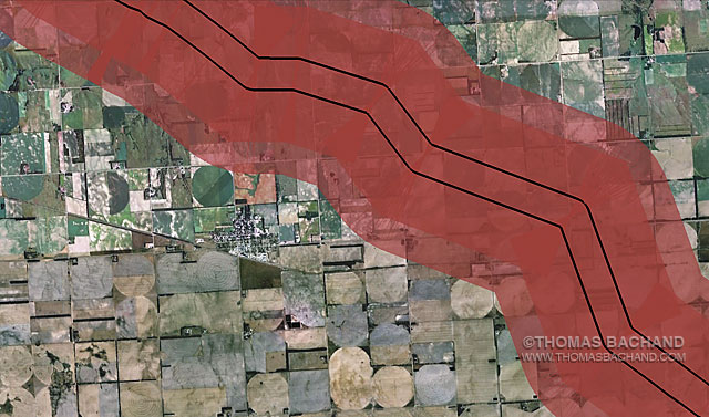
Voluntary Evacuation Zone. Orchard Nebraska.

Voluntary Evacuation Zone. Orchard Nebraska. From the Keystone Mapping Project.

Voluntary Evacuation Zone. Orchard Nebraska. From the Keystone Mapping Project.

The Keystone XL Voluntary Evacuation Zone is based on the health department response to a diluted bitumen spill in Michigan’s Kalamazoo River. Drawn from the Keystone Mapping Project Google Earth view, these images form the basis for Thomas Bachand’s VEZ Grid Abstracts series, an exploration of both our perception of, and impact upon, the landscape — seen and unseen. Combining satelite imagery with custom mapping features, the panels examine the interplay of physical and human geography. In series, the photography reveals broader patterns and larger questions. For more, visit the Voluntary Evacuation Zone.

Registered © Thomas Bachand. All Rights Reserved.
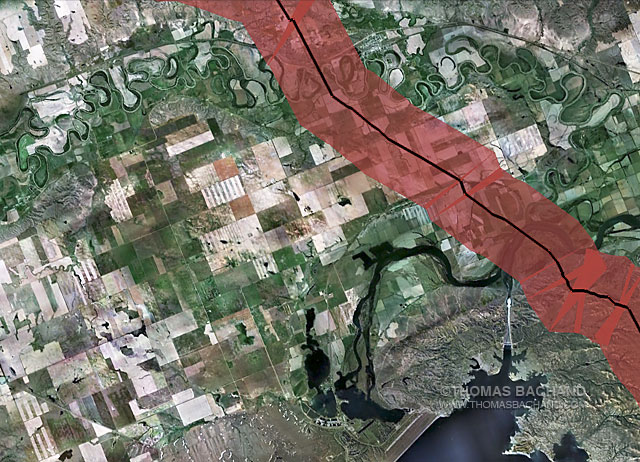
Voluntary Evacuation Zone MP86

Voluntary Evacuation Zone. Approimately milepost marker 86. Montana. From the Keystone Mapping Project.

Voluntary Evacuation Zone. Approimatley milepost marker 86. Montana. From the Keystone Mapping Project.

The Keystone XL Voluntary Evacuation Zone is based on the health department response to a diluted bitumen spill in Michigan’s Kalamazoo River. Drawn from the Keystone Mapping Project Google Earth view, these images form the basis for Thomas Bachand’s VEZ Grid Abstracts series, an exploration of both our perception of, and impact upon, the landscape — seen and unseen. Combining satelite imagery with custom mapping features, the panels examine the interplay of physical and human geography. In series, the photography reveals broader patterns and larger questions. For more, visit the Voluntary Evacuation Zone.

Registered © Thomas Bachand. All Rights Reserved.
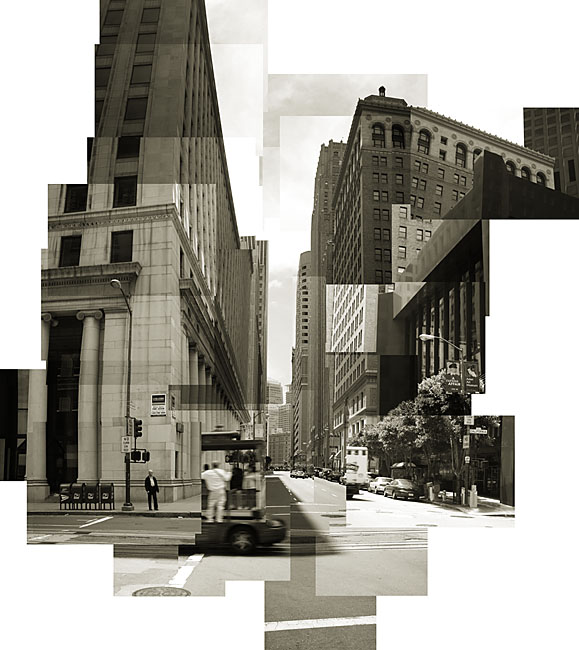
Montgomery Street

Montgomery Street. San Francisco.  From the Digital History Series.

Montgomery Street. San Francisco. From the Digital History Series.

In Digital History the iconic landscape becomes a milepost. We live in an era of change and convenience documented through ubiquitous imagery. The camera has become a casual companion, fundamentally altering photography and our perception and use of the medium. As a landscape photographer, I am interested in how this informs our awareness of our surroundings and, thus, our moment in history and perspective as both visitor and viewer. For more, visit my Digital History portfolios.

Registered © Thomas Bachand. All Rights Reserved.

Mt. Broderick

Mt. Broderick. Yosemite National Park. From the Digital History Series.

Mt. Broderick. Yosemite National Park. From the Digital History Series.

Yosemite is an iconic landscape that has been closely examined by artists for well over a century. In keeping with this tradition, my photography of the park is varied and experimental. For more, visit my Yosemite and Digital History portfolios.

Registered © Thomas Bachand. All Rights Reserved.