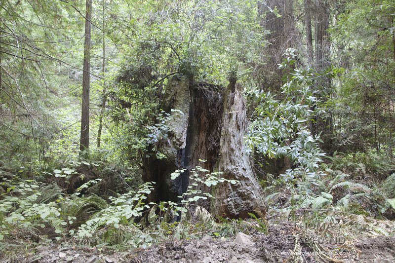
Part of my new series, Old Growth, this work explores California’s redwood forests and the enigma of old growth. We treasure these primal forests, yet less than five percent remain.
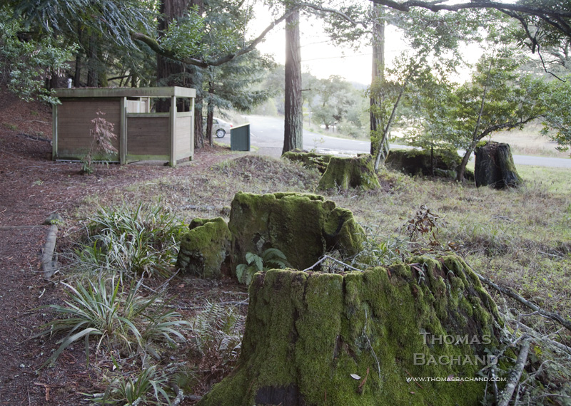
Part of my new series, Old Growth, this work explores California’s redwood forests and the enigma of old growth. We treasure these primal forests, yet less than five percent remain.
Part of my new series, Old Growth, this work explores California’s redwood forests and the enigma of old growth. We treasure these primal forests, yet less than five percent remain.
A friend of mine brought to my attention the Lake Tahoe Wildlife Care, a non-profit in the Tahoe basin doing important work “to raise, rehabilitate and release orphaned and injured wild birds and animals.” With so much pressure on the natural environment in and around Lake Tahoe, LTWC fills a vital niche.
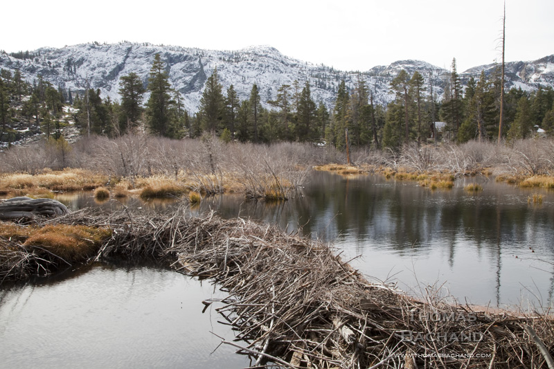
Beaver dam. Glen Alpine Creek watershed. Fallen Leaf Lake. South Lake Tahoe, CA.
In celebration of the Nevada Museum of Art’s “Tahoe: A Visual History,” this week’s posts are drawn from my Lake Tahoe work.
This image is part of my long term study of the Lake Tahoe region. More of my Tahoe work can be found at Lake Tahoe photography. For more on my best-selling monograph, visit Lake Tahoe: A Fragile Beauty (Chronicle Books).
For information on this image, including archival print purchase, contact me with the title of this post.
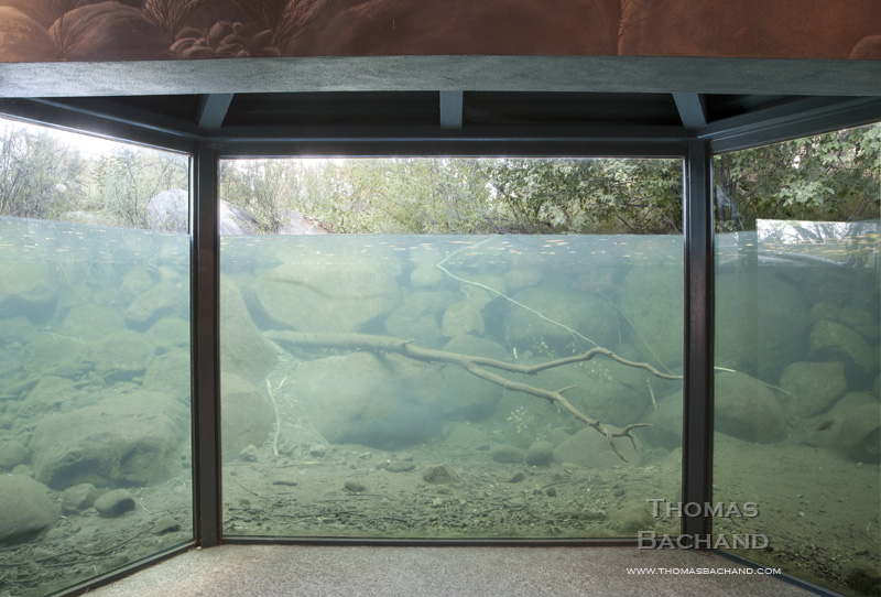
Taylor Creek Stream Profile Chamber. South Lake Tahoe, California.
In celebration of the Nevada Museum of Art’s “Tahoe: A Visual History,” this week’s posts are drawn from my Lake Tahoe work.
This image is part of my long term study of the Lake Tahoe region. More of my Tahoe work can be found at Lake Tahoe photography. For information on my best-selling monograph, visit Lake Tahoe: A Fragile Beauty (Chronicle Books).
For more information on this image, including archival print purchase, contact me with the title of this post.
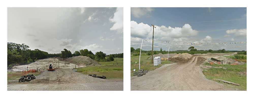
Diptych Series: Crossings. Keystone XL construction on State Highway 48. Oklahoma. Google Street View 2013.
In Crossings, the controversial delivery of tar sands oil to Port Arthur, Texas is examined at ground level through the dispassionate eye of Google Street View, the automated documentarian of our nation’s roadways. The 180° diptychs compiled here are composed of opposing camera views from each intersection between the Keystone XL pipeline corridor and the roving camera. This is a historical moment, captured incidentally, accessible for a year or so, and then deleted from the record at the next passing of the camera.
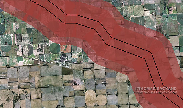
Voluntary Evacuation Zone. Orchard Nebraska. From the Keystone Mapping Project.
The Keystone XL Voluntary Evacuation Zone is based on the health department response to a diluted bitumen spill in Michigan’s Kalamazoo River. Drawn from the Keystone Mapping Project Google Earth view, these images form the basis for Thomas Bachand’s VEZ Grid Abstracts series, an exploration of both our perception of, and impact upon, the landscape — seen and unseen. Combining satelite imagery with custom mapping features, the panels examine the interplay of physical and human geography. In series, the photography reveals broader patterns and larger questions. For more, visit the Voluntary Evacuation Zone.
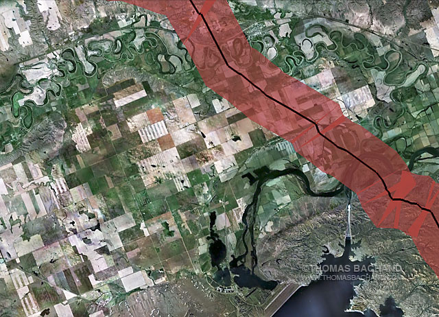
Voluntary Evacuation Zone. Approimatley milepost marker 86. Montana. From the Keystone Mapping Project.
The Keystone XL Voluntary Evacuation Zone is based on the health department response to a diluted bitumen spill in Michigan’s Kalamazoo River. Drawn from the Keystone Mapping Project Google Earth view, these images form the basis for Thomas Bachand’s VEZ Grid Abstracts series, an exploration of both our perception of, and impact upon, the landscape — seen and unseen. Combining satelite imagery with custom mapping features, the panels examine the interplay of physical and human geography. In series, the photography reveals broader patterns and larger questions. For more, visit the Voluntary Evacuation Zone.