Why Aren’t Tahoe’s Boaters Paying Their Way?

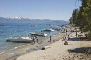
Boats illegally moored to beach. Sugar Pine Point State Park. July 2, 2011

Boats illegally moored to beach. Sugar Pine Point State Park. July 2, 2011

It’s become common knowledge that invasive species are a significant threat to Lake Tahoe’s ecosystem and water quality.  The Tahoe Environmental Research Center offers an overview on the lake’s invasive species and history on their website.  Given that invasive species are most commonly introduced into the lake by boaters and occur in greater concentrations near marinas, it is perplexing that the boating community is not making a greater effort to protect Lake Tahoe.

While the boating community is to be commended for getting on board with invasive species boat inspections in a single year, there is ample opportunity for boaters to be proactive and to mitigate their effects on Tahoe.  Lakefront property owners obstruct views and access with their piers and buoys.  Boat noise is a constant din during summer.  Once a boat is launched into the lake, it enjoys free use of the entire lake.  Even where boating restrictions exist, short staffing at parks and sheriff departments hinders enforcement.

The photograph above shows a typical summer day at Sugar Pine Point State Park where boaters illegally beach their boats, effectively prohibiting paying park users from swimming or walking along the shore.  The park claims that they do not have the staffing to patrol the beach.  In effect, the non-paying park users prevent legitimate park patrons from using the beach.  If the park is unable to properly monitor a given activity, it should be banned altogether instead of allowed to persist unabated.

It is perplexing as to why boaters are not paying the  annual state parks use pass fee (plus additional camping fees when applicable) for water access to California’s parks.  In addition, it only seems appropriate that boaters should pay additional fees to fund ongoing invasive species eradication programs.   These fees could easily be assessed when boat owners register their boats and submit to inspections.

By paying their way, boaters would strengthen stewardship of Lake Tahoe instead of weakening it by overtaxing already strained resources.  The funds would go a long way towards keeping parks adequately staffed and increasing the protection of this national treasure.

If you agree with these sentiments, send an email Susan Grove (sgrove@parks.ca.gov), Superintendent at the California Department of Parks and Recreation, Lake Tahoe Sector, Sierra District.  Please CC the League to Save Lake Tahoe (info@keeptahoeblue.org).
Upper Truckee Meadow Restoration

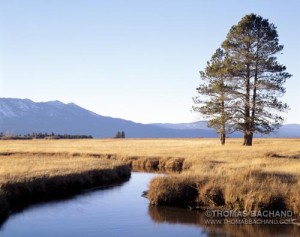
Truckee Meadow.  South Lake Tahoe, California

Truckee Meadow. South Lake Tahoe, California

More than that of leaves changing colors, Fall in the Sierra is a time of golden grasses.  Above, the Upper Truckee River meanders toward the shore of Lake Tahoe.

This meadow is part of the largest wetland in the Tahoe basin, stretching back several miles along Highway 50 towards Echo Summit.  In the last half century this area has seen dramatic changes.  Christopher Soulard and Christian Raumann of the United States Geological Survey have compiled historic orthoimagery data on South Lake Tahoe, of which this meadow, being adjacent to Tahoe Keys, is of particular note.  In fact, Google Earth used the USGS Tahoe data for its first historical imagery sample (read about it in the New York Times).  The dredging of Tahoe Keys has created some of the most dramatic environmental damage to the Tahoe ecosystem.

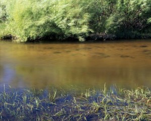
Riverbank. Upper Truckee Meadow. South Lake Tahoe, California.

Riverbank. Upper Truckee Meadow. South Lake Tahoe, California.

Today, the Upper Truckee is the focus of major environmental restoration.  Of primary concern is a golf course that restricts and narrows the river’s flow and is a significant source of sedimentation into the lake.  Over the last twenty years the realignment of the river through the golf course has, in some parts, eroded 50 feet of the embankment.  The current plan calls for moving the golf course into undisturbed neighboring lands in Washoe Meadows State Park so as to restore the river’s natural flow and its adjoining riparian habitat.  This plan has upset both golfers, who are concerned about increased course fees, and environmentalists, who wish to protect surrounding forest lands.  The park enjoys the golf revenue and says that the forest land to be offset by the golf course is not endangered habitat and is scarcely used (by humans).  Now that I know the park is there, I’ll go visit it.  Just sayin’.

Read about the Upper Truckee restoration in the Sacramento Bee here. The Upper Truckee Restoration EIR and other project information can be found here.

The Buried Lead. 2011 State of the Lake.

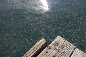
Lake Tahoe from edge of pier.  Sugar Pine Point State Park.  California.

Lake Tahoe from edge of pier. Sugar Pine Point State Park. California.

A couple of years ago on a warm, mid-summer day, we launched our kayak onto Rubicon Bay’s clear and smooth waters – so clear, it felt as if we were flying over the rippled sands 20 to 30 feet beneath Tahoe’s surface.  Paddling toward deeper water, the sandbar suddenly ended and the lake bottom plunged into the darkened depths.  As if suspended, we felt a sense of vertigo.

This year, after Labor Day, we returned once again to “fly” above Rubicon’s sandy bottom.  To our dismay, the waters were clouded, the lake bottom detail indistinguishable and, as we paddled into deeper water, the green of the shallows simply faded to the black of the depths.  To quote Marlin from Finding Nemo, “Good feeling gone.”

Following the publication of the 2011 State of the Lake Report by the Tahoe Environmental Research Center and its finding that lake clarity dropped by four feet in 2010 (to 64 feet), there were a number of articles on  current conditions at Tahoe (UC Davis, Los Angeles Times, KQED).  In recent decades Tahoe research has become increasingly sophisticated and comprehensive.  While the Secchi disk depth-visibility measurement continues to be the benchmark on clarity, today, a more broad set of factors are being examined, including stream runoff, road dust, lake temperature and mixing, invasive species, forest conditions, and remote sensing data.  It is clearly understood that Tahoe’s problems circulate with the waters and are not confined by borders.  My summer Rubicon excursion leads me to believe that next year’s State of the Lake report will detail a steeper decline in clarity.

The buried lead in the report is that, just as the lake knows no borders, our political approach must not either.  The authors underscore the need for continued cooperation between California and Nevada (i.e. support for the Tahoe Regional Planning Agency – TRPA).  Meanwhile, the media has given little attention to Nevada’s intent to pull out of TRPA.  The state feels the bi-state agency hinders development.  Many of us find this odd as TRPA exhibits a pro-developer bias and has yet to turn down a major project.  Regardless, California’s politicians are scrambling to negotiate with Nevada.  Nevada’s tactics are familiar: invent a crisis whose resolution serves your special interest.

Lake Tahoe now finds itself the latest target of the deregulators and science deniers.

Lenticulars – Autumn Sierra Skies

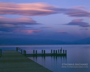
Dusk upon pier, Sugar Pine Point State Park, Lake Tahoe, California

Dusk upon pier, Sugar Pine Point State Park, Lake Tahoe, California

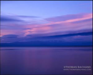
With Fall comes shifting weather patterns and, for the high Sierra, high altitude winds, thunderstorms, and spectacular cloud shows.  The cover photo for my book “Lake Tahoe: A Fragile Beauty” was an afternoon in the making, as large lenticular cloud formations took shape over the lake.  I kept an eye on this one throughout the afternoon and, was surprised that it was still holding shape as the afternoon waned.  Along the west shore I found a good vantage for the southern end of the cloud, the remainder of which stretched nearly to North Shore (below).

Lenticular Cloud Over Lake Tahoe

Lenticular Clouds Over Lake Tahoe

These exposures came well after sunset as the last of sun’s glow was reaching the clouds and skylight was bathing all in blue.  The exposures are approximately one minute at f64 on a 4″x5″ large-format view camera.

Lake Tahoe’s Impervious Surfaces

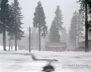
Off Season.  Homewood Ski Resort.  Lake Tahoe, California.

Off Season. Homewood Ski Resort. Lake Tahoe.

Here’s another highlight of the work going on at the Desert Research Institute.  Mary Cablk studies the connections between wildlife and the landscape.  One of her projects of particular note for Lake Tahoe, developed a method for calculating impervious cover areas using remote sensing.  This work is significant to Tahoe where impervious surfaces are an important contributing factor to the lake’s loss of clarity.  Mary’s work takes her further afield, as well, including studies on pine martens, lizards, tortoises, and coyotes.  In the desert near Joshua Tree National Monument, Mary is utilizing K9’s to locate and survey desert tortoises.

For more information on Mary’s work, visit her website.

Skiing Green

Lake Tahoe hotels and resorts rated on environmental efforts.

Lake Tahoe ski resorts receive environmental ratings.

An interesting article from the Associated Press discusses the Ski Area Citizens Coalition’s ninth annual environmental review.  According to the article, Mt. Rose received a typical rating for a Lake Tahoe ski resort:

With an overall B, Mount Rose’s categorical scoring was consistent with the majority of the resorts. The mountain on the southwest edge of Reno halfway to Lake Tahoe earned an A for habitat protection and B for watersheds, but a D for doing too little to address climate change and an F for environmental practices.

Check out the article here.

TRPA. Impartial?

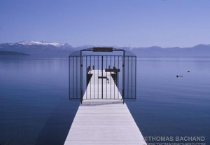
Gated pier, Lake Tahoe, California

Recent events have brought to mind an interesting Op-Ed from the San Francisco Chronicle in support of a federal judge’s injunction against the Tahoe Regional Planning Agency’s (TRPA’s) policy allowing an increase of piers and buoys in Lake Tahoe.

At Tahoe, I am reminded often of the old joke that the best two days of a boat owner’s life is the day he buys the boat and the day he sells it.  The commerce surrounding boats and marinas at Tahoe certainly contributes to the local economy.  I am unclear, though, as to why piers cannot be shared.  I put this question to one home owner who would like to install a pier.  “It raises our home value,” was the answer.  From my perspective, on the lake in a kayak enjoying the shoreline, the piers detract from the property value.

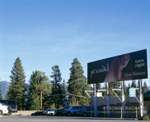
The SacBee has reported on the new “eco-friendly” development Boulder Bay Resort & Wellness Center resort being planned for the Biltmore property at North Shore stateline.  The supporters champion the green roofs, reduced erosion, the resort’s emphasis on spa rather than gambling, and, of course, jobs.  The critics question the traffic, the need for another resort, and TRPA’s eventual build-out of Tahoe.  Current resort development projects elsewhere on the Lake Tahoe include the major South Tahoe Redevelopment and the gearing up of Homewood Mountain Resort’s make-over and expansion.

In the Bee article, TRPA spokesman Dennis Oliver is quoted:

Oliver believes deeper currents are swirling. “A lot of these conflicts and lawsuits are about the environmentalists wishing the world were different,” he said. “They want their reality to dictate policy.” And, he added, “Their fundraising depends on conflict.”

These are unfortunate remarks, which, when turned around, raise interesting questions of their own.  How does TRPA view the world?  What does their “fundraising” depend upon?

Or as one reader commented to me:

Just replace the word “environmentalists” with “developers” in the spokesman’s quote above, and you’ll know what the real situation is.  I looked up the Tahoe Regional Planning Agency’s mission:  “The Tahoe Regional Planning Agency cooperatively leads the effort to preserve, restore and enhance the unique natural and human environment of the Lake Tahoe region now and in the future.”  That a spokesman for an agency supposedly charged with protecting resources for future generations could make such a ridiculous statement is an indictment of their organization.

Historic Shoreline Change at Lake Tahoe from 1938 to 1998 and Its Impact

Wetland. South Lake Tahoe, California.

In the next few posts I wanted to turn people on to some of the great work being done on Tahoe by the folks at the Desert Research Institute.

A few years back Ken Adams and Tim Minor wrote a shoreline study:

“Historic Shoreline Change at Lake Tahoe from 1938 to 1998 and Its Impact on Sediment and
Nutrient Loading” ( Journal of Coastal Research, Vol. 18, No. 4 (Autumn, 2002), pp. 637-651, Published by: Allen Press)  You can find it here:  http://www.jstor.org/stable/4299116

They found that 7,150 metric tons of shoreline sediment erode into Lake Tahoe each year.  From this, they estimate that approximately 2 metric tons of phosphorus and 1.8 metric tons of nitrogen also wash into the lake each year. These shore zone erosion rates are second only to stream loading.  They conclude that shore zone erosion contributes significantly to sediment loading and less so to the Lake Tahoe’s nutrient budget.

Boating on Lake Tahoe This Summer?

Spring Boat.  Homewood.

Spring Boat. Homewood.

Passing this along from the League to Save Lake Tahoe:

Boating on Tahoe This Summer?
Do Your Part

An infestation of invasive mussels is an immediate threat to Lake Tahoe this summer.  The quagga and zebra mussels reproduce and colonize quickly and if introduced to Lake Tahoe would do irreparable damage to our ecosystem.

The League is urging all users of Lake Tahoe to limit their boating to “dedicated” boats – that is, to use ONLY boats and accessories (including kayaks, canoes, paddleboards, and other flotation devices) that are used SOLELY on Lake Tahoe, and not on other water bodies.  We know this is a sacrifice for many, but we think it is the right thing to do – the risk to Lake Tahoe is enormous, and both boating and beach enjoyment could be lost for all if these invaders infest and establish themselves here.

Boat inspectors have already discovered a number of invasive species on boats attempting to launch at Lake Tahoe.  Luckily, the boats have been quarantined and decontaminated.  But we all must realize that often times quagga and zebra mussels can be extremely difficult to see – please help us to protect Lake Tahoe by taking the following precautions:
• If you’re planning to launch a boat from shore and the boat has been in any other body of water, be sure to clean, drain, and dry it completely.  Give it a thorough visual inspection.  If you notice anything suspicious, take it to a public boat launch where it can be examined by a certified inspector.  Click here for boat launch hours and info.
• All public boat launches and marinas are now staffed by a boat inspector who examines boats for evidence of mussels.  Boat launches are only open when an inspector is present.  Click here for hours of public boat launches.
• Inspection fees for motorized boats range from $10-60 depending on the size of boat.   All funds go directly to the inspection program.  There is currently no charge to inspect a nonmotorized watercraft.
For more information, visit www.protecttahoe.org. Thanks for helping to Keep Tahoe Blue and mussel free!

Carleton Watkins and a “First Glimpse” of the West

Lake Tahoe: A Fragile Beauty

Impromptu Boundary

After the loss of his studio and archives to bankruptcy, Carleton Watkins began work on his New Series, where upon he re-photographed the West and rebuilt and expanded his photographic archive. A commission by the Hearst Mining Company brought him to Virginia City, Nevada. Watkins also photographed mining operations near Markleeville, California and Carson City, Nevada, railroad and water projects near Donner Summit, and hydraulic mining operations further west in California’s Gold Country.

While passing through Lake Tahoe he would take pictures of the resorts, as well as general lake views. He would also take portraits for the lumberjacks employed in the Tahoe Basin logging timber for the mines of the Comstock Lode.

Included in Lake Tahoe: A Fragile Beauty, alongside the Twain essays are a selection of Watkins New Series Tahoe photographs provided by the Phoebe Hearst Museum of Anthropology on the UC Berkeley campus. We only had space for a small number of images in Lake Tahoe: A Fragile Beauty, yet Phoebe Hearst’s collection of 140 Watkins photographs are the basis for the museum’s photography collection. I strongly encourage readers to visit the Phoebe Hearst Museum and the Online Archive of California to see more of Watkins’ photography from the area. As one fascinated by how the land speaks to our relationship with nature and the environment, I find the photography of Virginia City and Markleeville particularly engaging.

In general, I find Watkins’ work captivating. During the late-19th Century, his photography gave eastern audiences important views of a western landscape they were only able to read about, leading, ultimately, to the founding of Yosemite and other national parks. Today, these photographs offer another important first glimpse – for us. Watkins allows us to look back upon the land, exactly at the arrival of our industrial culture. The Gold Rush was the first human migration in history blessed so. It was a time not so long ago.